A section of an old unscaled sketch map (source unknown) was sent in by one of our regular site visitors showing two early coal pits in the Markinch area, probably dating from the early 19th century.
Text on the sketch map includes:
West Markinch Pit ... Inchunie Pit ... A sketch of
Inchunie mind without a scale ... Cutted pavement ... the
dotted line represents coal ... a hitch ... coal ... another
hitch ...
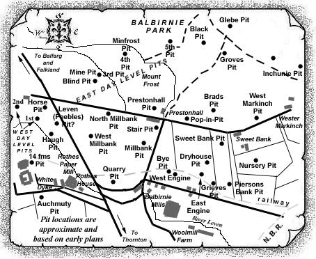
We have since gained further information on these - the West Markinch and Inchunie Pits - which were sunk in Balbirnie Park, to the west of Markinch village.
West Markinch Pit probably dates from around 1814, its shaft reaching the Main Coal at 20½ fathoms; and the Under Coal at around 28 fathoms. Situated on the level course from the East Engine Pit, the Main and Under Coals were probably worked from this shaft both east towards the outcrop; and west towards the older workings.
 |
 |
| See also Balbirnie Colliery entry (East Fife Index) for full details of the old workings of this very important, early Fife coalfield near Markinch. |
|---|
