Owners: Star Coal Company
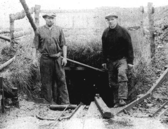
Star is a small hamlet situated to the north-east of
Markinch, Fife. Two coal seams were opened up by means of a
surface mine immediately south of the road bridge over the
Kennoway Burn, about 500 yds. west-north-west of Burnside. It
was sunk in the field known locally as "The Common" and employed
only a handful of men working a small, isolated basin of coal.
Workings in these two seams are believed to
have taken place in the vicinity of the Star Mine around 1777
when caution was advised
concerning any future mining enterprise to the west of the
bridge and to the north of the Kennoway Burn.
A very small
amount of coal was removed south of the stream before the
mine was finally abandoned around 1924/25.
 |
|
Information on coals worked at, or near, Star Mine
(based on a report from 1954)
The lower of the two coals worked here was called the
Starlight and was reported to have been 3 ft. thick
including a 2 in. clay parting 6 in. from the bottom. It was
succeeded by about 6 ft. of blaes and fireclay and then by
sandstone.
The second
coal, named the Cherrie, was found 37 ft. above the
Starlight, the intervening layers being chiefly sandstone.
The Cherrie Coal gave the following section:
| Description | Depth |
| Hard fakes and blaes
(below sandstone) |
2 ft. 6 in. |
| Black blaes | 1 ft. 2 in. |
| 'Tumphy' | 4 in. |
| COAL with 12 in. PARROT | 1 ft. 10 in. |
| COAL, stony | 4 in. |
| Fireclay | 4 in. |
| Sandstone | - |
The exact position of these two coals in the succession is not
known, but there can be little doubt that they occur in the
lower part of the Limestone Coal Group, probably at about the
horizon of the Dunfermline Splint and Five Foot Coals.
An outcrop of coal on shale, probably the Starlight Coal, was
formerly seen about 75 yds. west of the bridge and 30 yds.
south of the stream. A 4 ft. coal, formerly seen in the
Kennoway Burn about 170 yds. north-west of Burnside, was
probably the seam correlated with the Blairhall Main.
In the bank of the small stream about 400 yds. north-east of the
road bridge at Langdyke, just over a mile to the north-east of
the Star Mine, there was exposed, from above
downwards, the following section:
| Description | Depth |
| Coaly blaes | 2 ft. |
| Grey blaes | 3 in. |
| Coaly blaes | 3 in. |
| Grey blaes | 6 in. |
| Coal and coaly blaes | 2 ft. 3 in. |
| Fireclay | 1 ft. |
| White sandstone | 3 ft. |
| Faky fireclay | 3 ft. |
The beds had a low westerly dip of 15o. Two other outcrops of thin coals could be seen in the same stream, one on either side of the bridge and distant from it some 60 to 70 yds. The beds were inclined to the south-east at 5o, but south of the bridge the dip gradually swung round through south to south-west. The position of these coals in the succession is not known.
| Plan of Abandoned Seams for Star | Pits or Mines designated in Plan |
|---|---|
| COAL; Cherrie
(Abandoned 7th November, 1923); Starlight (Abandoned 9th June, 1925) |
Star |
--------------------------------------------