Owner: not known
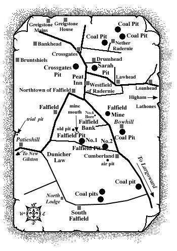
A trial pit, just 400 yds. to the north-west of
Patieshill, near Backmuir of New Gilston, has been identified
from a map record recently researched in September, 2002.
An appended note states, "A 3 ft. coal said to have
been worked long ago in the East Field, near Patieshill.
Heavily watered and abandoned."
 |
| The locations of pits or mines, in respect of
which names, dates and particulars of workings have not
been available, may be indicated in abandonment plans
under the Parishes in which they are situated. It was
just such a record that first suggested to us that coal
was worked here to the north of Patieshill (now
Peattieshill) farm and approximately ½ mile west
of Falfield.
The duration of this pit is likely to have been fairly brief due to the flooding reported. No details of shaft depth or coal seams worked are known. M. Martin & Webmasters |
The coalfield around Falfield
This tract of ground was surrounded by large masses of intrusive igneous rock, and was so broken with faults that its detailed structure was not known at the end of the nineteenth century. It was bounded on the south by Dunicher Law and on the south-east, it merged into the Largoward coalfield. Its eastern limit was formed by the dolerite of Lathones. Its northern margin was defined by the large fault that separated it from the Radernie coalfield, while on the west it ran up to the edge of the dolerite sheets of Bruntshiels and Bankhead (see above map).
