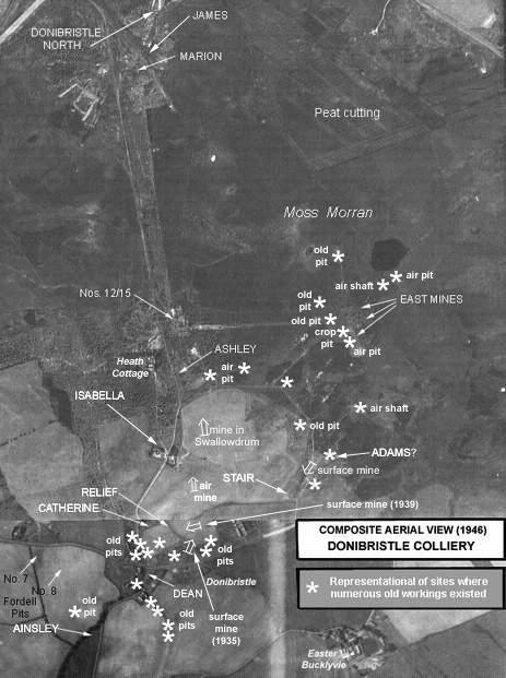
Just north of the Crossgates-Auchtertool road and the old village of Donibristle, the Relief Pit was located just yards to the east of the site of the later Catherine Pit. The depth of the Relief Pit has been recorded in two sources as either 21 or 25 fathoms. Likely to have been in operation from around 1835 working the Mynheer seam initially, its closing date is not known.

|
 |
| See Central Fife Index Entry 'Donibristle Pits & Mines' for colliery details |
|---|
| Plans of Abandoned Seams for Relief Pit | Pits or mines designated in Plans |
|---|---|
| COAL; Splint; Mynheer (1838) | DONIBRISTLE
Ainslie; Catherine; Dean; Relief |
| COAL; Seam unnamed (1851) |
DONIBRISTLE
Ashley; Engine; Isabella; Relief |
| COAL; Splint (1850); Fourteen Feet (1919); Gorman (1920); Jewel; Wee (1921) |
DONIBRISTLE
Nos. 12, 15; Catherine; Isabella; Relief |
----------------------------------
"Dunfermline Journal"
13 July, 1900
... With the Relief Pit, attention began to be devoted to the field to the north of the public highway. Pumping and winding engines of same pretensions were placed on the Catherine, which was sunk to the Mynheer seam; and, strange to say, the Dunfermline Splint was gotten at the same depth, having been thrown up by a dyke at a point in the field right opposite the Mynheer. ...
