Owners: probably Beath and Blairadam Colliery Company then Fife Coal Company
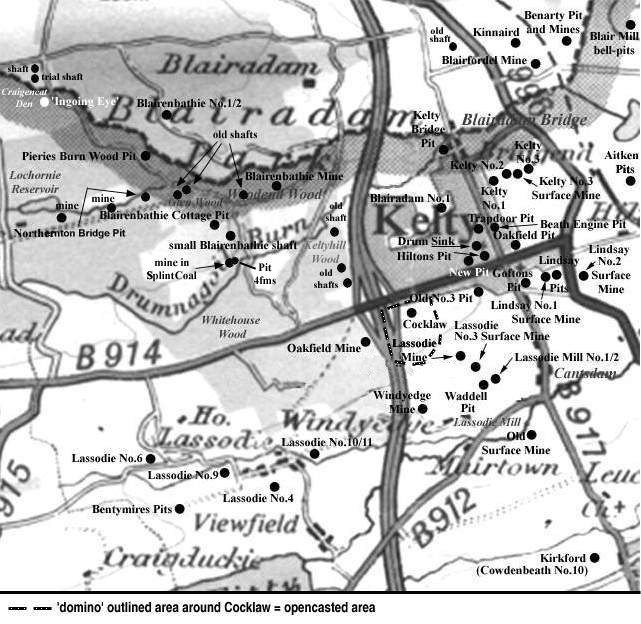
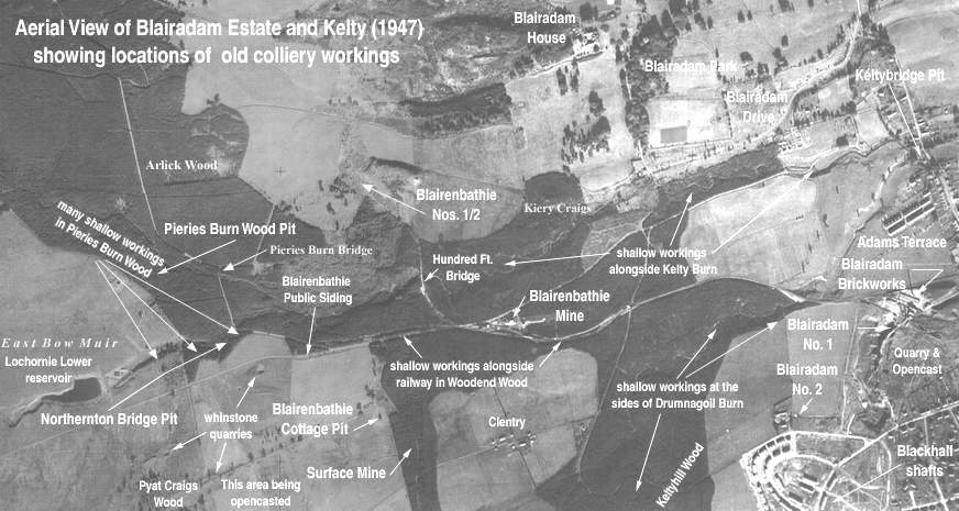
A number of small pits worthy of 'Pieries Burn Wood Pit' status were probably located in the west Kelty, Blairenbathie coalfield, by the sides of the Pieries Burn and in the neighbouring wood. Two of the 'Pieries Burn Wood Pits' are more clearly identified; one on a map of 1856; and a later one is described as being sunk by the side of the Burn around 1873, by the then recently-formed Fife Coal Company, to a depth of 40 to 50 fathoms. The working life of the earlier pits in this remote burn and wood area to the west of Kelty is not known but the two later pits are likely to have ceased coaling around 1875 as the Fife Coal Company was closing its unprofitable pits including, also, Northernton Bridge Pit by the Lochornie Burn.
 |
 |
|
The short historical note which follows has been
contributed to explain the existence of the shallow
workings frequently mentioned in geological memoirs
from which some site information is obtained and which
are common to the excavations around Kelty Burn,
Pieries Burn, Drumnagoil Burn, Lochornie Burn, Woodend
Wood and Keltyhill Wood - all locations to the west of
Kelty.
Following the last Ice Age (about 30,000 years
ago) the land was covered by thick beds of glacial
deposits comprising sand, clays and gravels. Subsequent
streams and rivers cut through these relatively soft
deposits and exposed the solid layers of rock
(including coal) in the sides of the valleys and gorges
formed by the erosive action of the water. History
tells us that coal was most likely to be first mined
at, or near, these locations. Dunfermline Glen, Esk
Valley in the Lothians, Rhonda Valley in Wales,
Tyneside in Northumberland and the Ruhr in Germany are
typical examples.
|
Information on coals worked at, or near, Pieries Burn Wood Pits, Kelty
(based on a report from 1900)
Around the end of the nineteenth century, in the western
side of the Kelty basin, there were numerous traces of
shallow workings in the Glassee Coal seam which lay from 8 to
10 fathoms above the Mynheer Coal seam. The Glassee Coal was
rather poorly developed in the Blairenbathie coalfield and
ranged from 2 ft. 3 in. to 3 ft. 9 in. thick.
Small quantities of this coal are known to have been taken
out at the Pieries Burn Wood Pit where it averaged 2 ft. 7
in. thick and may have contained a foul rib. The roof of the
Glassee Coal seam in this area was frequently an impure
ironstone and the overlying blaes contained ironstone ribs
and nodules.
